Tongariro Crossing Guide | New Zealand
Question: How do you reach the Tongariro Crossing, on New Zealand’s North Island; in order to complete the epic 20km hike by public transport?
Answer: With some difficulty, though it is not impossible.
Follow-up Questions: Why would you want to?
I set off travelling just over three months earlier and gave myself the challenge of trying only to use land based public transport.
This was easy enough for the stretch between Manchester (UK) and Ho Chi Minh City (Vietnam). However, to reach New Zealand I flew, landing at Auckland
Once in New Zealand, because I didn’t want to hire a car as a solo traveller, I chose to use trains and buses.
Hiking the Tongariro Crossing was one of the ‘bucket list’ experiences I wanted to have and this article outlines how I did this:
- Getting to the Tongariro National Park
- Staying in the National Park
- Getting around the National Park
- Hiking the Crossing
So, let’s get started…
How to Get to Tongariro National Park
You can travel by bus and InterCity Buses offer a reasonably priced service to and from many locations around New Zealand.
Choosing to travel by train using the Northern Explorer because I had read that the journey across North Island is one if the most beautiful train journeys on the planet.
I found about this fabulous journey thanks to the Man in Seat 61, a fantastic resource for anyone who wants to travel anywhere by train. I have planned my entire trip and route using his page.
Booking the Explorer ticket from Auckland, you need to use the Great Journeys website. Tickets from Auckland to National Park (the station in the Tongariro National Park) are priced at — for New Zealanders or at — for international visitors.
International visitors can also use a VPN to gain the New Zealand price.
The journey does indeed take you through some beautiful scenery and onboard you can listen to an engaging audio commentary describing the history and the geography of the areas the train passes through.
Tongariro Crossing Accommodation
I chose to stay at the village of National Park. Many opt to stay at the nearby village of Whakapapa but accommodation is more expensive and, without a car, getting there is not straight forward.
Howards Mountain Lodge, Tongariro National Park
I stayed at Howard’s Mountain Lodge an entirely self-catering hostel geared up for walkers and hikers with the drying room being a very helpful bonus.
Facilities are clean. The showers are hot, which is just what you need after a long hike. The hot tub which you can use for free is also a great restorative.
There are two kitchens, one more basic than the other, though reasonably well stocked with utensils, pots and pans.
The best part is the lounge, pretty impressive DVD collection which OF COURSE includes a copy of The Lord of the Rings Trilogy. You’re in New Zealand – what else are you going to watch?
And, on chilly nights, even in Summer, there is a log burning stove making your viewing pleasure even cosier.
The Lodge staff are more used to having people stay for only a couple of nights and were surprised at my four night booking. However, the weather forecast was questionable and I was allowing time to get a day to hike the Tongariro Crossing.
Getting Around the Tongariro National Park
Far easier by car. There’s no getting away from that fact.
Shuttle buses can be booked to take you down to Whakapapa village, from where you can walk several trails to waterfalls, through alpine and rain forest up to the open moors.
Or you could have a hot chocolate with a scone at the Chateau Tongariro.
The essential reason for visiting Whakapapa is to pop into the Visitor Centre to find out about the Tongariro Crossing and other hikes in the area.
Shuttle buses can be booked by your lodge or hostel. They’re not cheap:
35NZD for a return trip to Whakapapa from National Park.
40NZD drop off at the Tongariro Crossing and pick up.
You will need to use a shuttle bus at least one way, even if you do have a car. The Crossing is a one way route not a circular route.
So, The Main Event, The Tongariro Crossing, New Zealand
The Crossing is 19.4km and climbs to almost 2,000m. Crossing the Red Crater of a volcano and passing the stunning Emerald Lake.
How to Plan before Hiking the Tongariro Crossing
Read up on the Crossing before you do it. It is not a casual stroll and the inappropriately dressed will be sent back to put on warmer clothes before being allowed on the Shuttle Buses to the start of the walk.
This happened to a girl I walked with.
If you drive yourself to the Crossing I doubt there is anyone to advise on suitable attire because I passed several young men wearing shorts or jeggings. It was 12°C at the bottom of the volcano but in the crater, the temperature can drop by 10°C.
Details of the route are here: https://www.tongarirocrossing.org.nz/the-track/tongariro-crossing/national-park/the-track
Advice on what to wear can be found here: https://www.tongarirocrossing.org.nz/national-park/tongiriro-alpine-crossing-must-haves
and here:
https://www.visitruapehu.com/things-to-see-and-do/tongariro-alpine-crossing/what-to-take/
If you’re in the area I’d also suggest popping into the Tongariro National Park Visitor Centre in Whakapapa to find out more about the immediate weather conditions and risks.
The staff are knowledgeable, informed and friendly and, crucially they give you accurate advice on the weather forecast and the likely conditions that you will experience at different altitudes.
However, the ten minute video, that I strongly recommend you watch is mildly terrifying and will help you decide whether you want to do the hike, after all.
The video takes you through the Crossing, describing the key stages and the hazards you should consider.
I found this incredibly helpful – understanding the terrain in terms of how steep and how much scrambling was going to be necessary; as well as being made aware of the effects that the rapidly changing weather can have on the path.
Hiking the Tongariro Crossing
So… what was hiking the Tongariro Crossing actually like?
It wasn’t guaranteed that I would be able to do it. For two days, the Department of Conservation had closed the track – it was far too windy for a safe crossing.
The shuttle buses were not running people to the start of the hike either.
This is a key point because on the third day, the Crossing was officially closed but the shuttle buses were still running. You don’t get your money back if you decide not to go after booking.
The shuttle bus picked me up from my hostel at 8am, along with *Reb who had asked to walk with me and at our next stop, *Sally joined us, after she had been told to wear trousers over her leggings.
The driver gave us advice about the pick up times from the opposite end of the hike, reassuring us that if we missed the last bus we could call them to come and get us, though we would be charged.
And if anything went badly wrong, there were always rescue helicopters. I was planning to avoid that necessity.
The first thing we noticed on arrival at the start of the Crossing, were signs saying that the route was closed. Though this was clearly not deterring the hundreds of people setting off on the trail.
∙ If we get stuck, will our insurance pay for the helicopter rescue?” asked Sally.
∙ As we have just walked past the huge sign that says ‘Do not enter’. I think we’ve just blown our insurance claims,” I said.
∙ Do we still want to do this?”
Yes, we did. We set of up the first couple of kilometres of the hike.
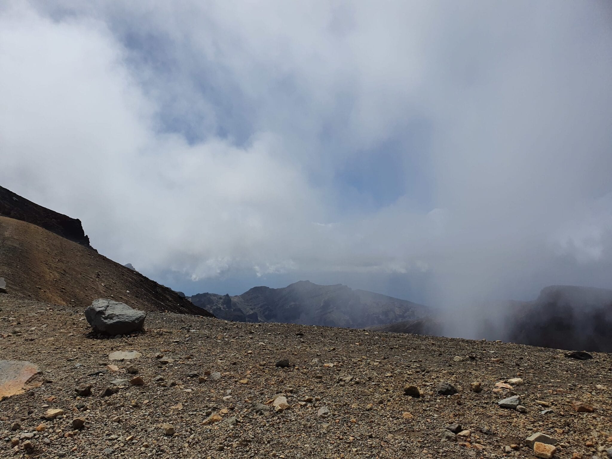
Cloud cover was so low that any hopes I had of spotting ‘Mount Doom’ in the distance were dashed.
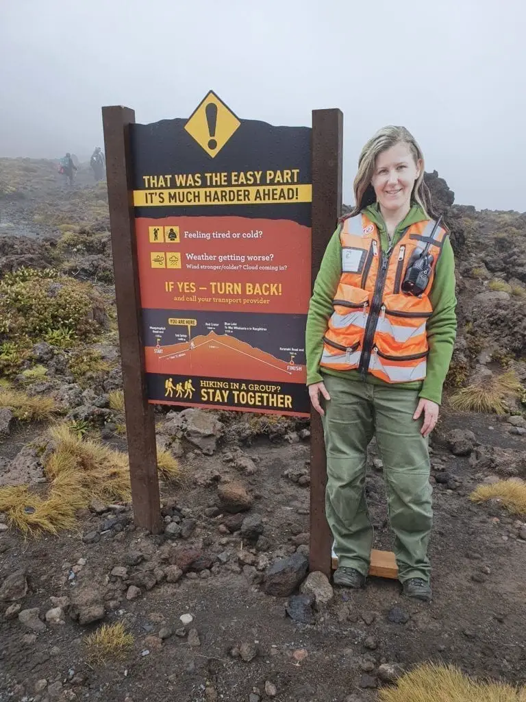
The incline took us up to the start of the lava field where melted rocks covered the slopes. This gently sloping walk was the easy part and here, we found our first warning sign.

We really should have turned back according to the guidance and I would not recommend anyone blindly follow what I did.
After a discussion about how we were feeling and looking ahead, we decided to continue. Reb trashed her travel insurance with a selfie next to the sign.
At this stage, the path was sheltered by the hills on both sides. The cloud obscured these but they moved aside often enough to provide some eerie views of the landscape and assurance that the second photo on the warning sign was not a permanent position.
Our other sign of safety was that we were not alone in doing this walk. There were lots of hikers on this trail.
We reached the first key decision point, as described by the Department of Conservation video, with a spookily effective cut out figure. The first climb was just beyond this point
On reaching the sign that indicated we had reached a third of the way, we were feeling confident. The weather had been kind to us: no rain, the clouds parting to allow the sunshine through and temperatures were comfortable.
Walking through this crater was like being on the surface of another planet. Or at least how I would imagine the surface of another planet.
We reached the second key decision point.

The next stage would see us scrambling up the scree to the summit of the Red Crater and the cloud was shifting. The route was obscured at times, though never less than twenty metres in front of us.
Were we going to do this?
People around us were pressing on.
We did likewise.
That climb was frightening. Gusts of wind tugged at our legs and I found myself calculating the likelihood of my surface area giving the wind something to sweep away, in comparison with how heavy I am.
The only way to progress was to pause during a gust and move when the wind dropped.
I checked in with Sally and Reb.
Going back meant walking further through the wind and the summit was closer. The wind was behind us, rather than coming over the summit so we thought we’d be walking back into worse weather than we would by continuing.
We kept going and we reached the summit where the wind had dropped and the sun was shining.
It was worth it.
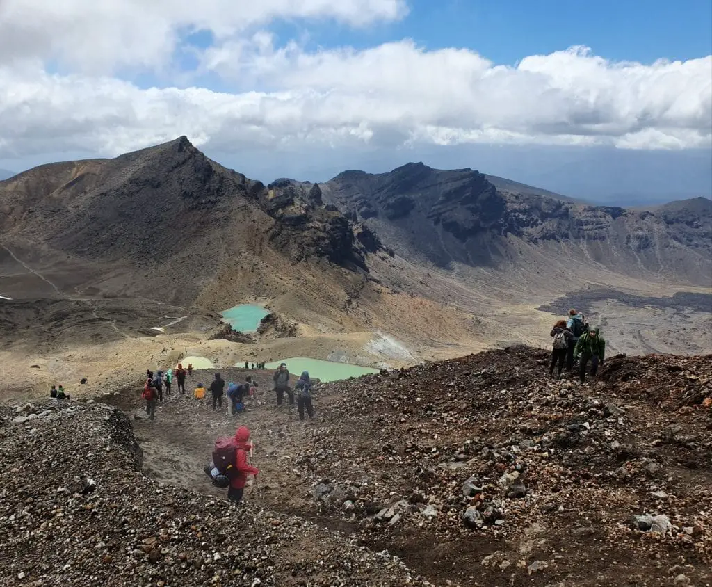
This was not the half way point.
The half way point was by the Blue Lake up ahead. Past the Emerald Lakes and a couple of snow patches.
From where she summoned the energy to run towards the snow I will never know. But Reb was unfeasibly excited about the white stuff.
I suppose that’s Australians for you.
(Sally and I are English. We get excited by sunshine).
After lunch, we set off on the long descent which is around one third of the route. The views across the Tongariro National park are incredible, even if I didn’t see Mount Doom.

By now, Sally was anticipating the celebratory food and drink she was going to consume when she got back to her accommodation. Nachos, melted mozzarella with a gin and tonic featured heavily, though once we got level with Ketetahi Hot Springs where the smell of sulphur was strong, she lost her appetite.
The Tongariro Crossing is an incredible hike. We felt a great sense of achievement that we completed it.
While there were people of all ages up there – a special award to the teachers who took a gang of teenagers up and over the Crater .
Serious point: this is a walk where you should consider your fitness levels before you do it.
I regularly hike in the Derbyshire Peak District and go walking in Snowdonia back in the UK. I am used to long hikes that involve some climbs. I’m also used to (and prefer) walking in cooler weather.
This is not a stroll to be taken wearing flipflops.
It’s not a circular route and you need transport to the start and from the end.
If you use the shuttle bus services both ways, the drivers sign you back onto the bus so if anything were to go wrong and you can’t call for help, someone would know you were missing.
The shuttle bus company I used was Tongariro Crossing Shuttles.
One thing to note, their travel advice may not tally with the information on arrival at the Crossing. The service was still running in the day I was walking the Crossing. Even though we were dropped off in front of a big sign that advised against walking that day.
Article and photos provided by PhileasFiona for www.loveyaguts.co.nz
